
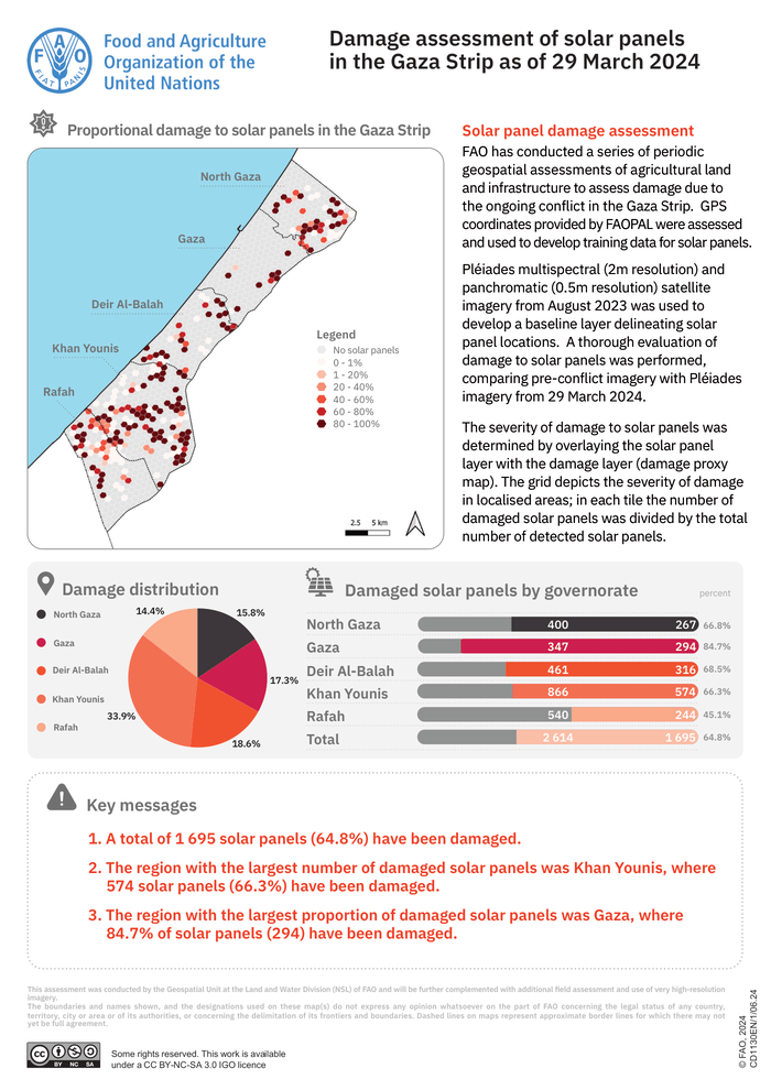
Solar panel damage assessment
FAO has conducted a series of periodic geospatial assessments of agricultural land and infrastructure to assess damage due to the ongoing conflict in the Gaza Strip. GPS coordinates provided by FAOPAL were assessed and used to develop training data for solar panels. Pléiades multispectral (2m resolution) and panchromatic (0.5m resolution) satellite imagery from August 2023 was used to develop a baseline layer delineating solar panel locations. A thorough evaluation of damage to solar panels was performed, comparing pre-conflict imagery with Pléiades imagery from 29 March 2024. The severity of damage to solar panels was determined by overlaying the solar panel layer with the damage layer (damage proxy map). The grid depicts the severity of damage in localised areas; in each tile the number of damaged solar panels was divided by the total number of detected solar panels.
This post was originally published on 3rd party site mentioned in the title of this site
